
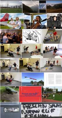
16. Sport und Freizeit


„Das Schachspiel hat wie die Liebe, die Musik, die Fähigkeit, den Menschen glücklich zu machen.
Ich habe ein leises Gefühl des Bedauerns für jeden, der das Schachspiel nicht kennt, so wie ich jeden bedaure, der die Liebe nicht kennt.“
―Siegbert Tarrasch - http://gutezitate.com/zitate/f%C3%A4higkeit/2
Das Wort Sport kommt aus dem Lateinischen "Zerstreuung"
NEWS >>>Beiträge vom Blick: >>> SPORT
Programme TV Fernsehprogramm geordnet nach Genre:
- Sport / Verschiedenes
- Sport / Boxen
- Sport / Eishockey
- Sport / Fußball
- Sport / Olympia
- Sport / Golf
- Sport / Gymnastik
- Sport / Handball
- Sport / Motorsport
- Sport / Radsport
- Sport / Tennis
- Sport / Wassersport
- Sport / Wintersport
- Sport / US-Sport
- Sport / Leichtathletik
- Sport / Volleyball
- Sport / Extremsport
- Sport / Reportagen


360° - FILM im Zeitraffer
FLUGPHYSIK ?
WASSERSPORT
Paragliding
am Zugerberg
Aufziehübungen
Mit dem Flyke (Veloflugzeug) PARAMOTOREN - Motorschirmfliegen
Modellsport RC
Drohnenflug
Gyrocopter
in Lomazzo


Crosswind


Avionics
Marbachegg
FRANCE
Akro
GPS Ortsangaben für die Tour in die Pyrenaen:
LFSB BALE MULHOUSE BASEL 47.590000 7.529167 4735N00731E
airport LFSB Bale Mulhouse 885 BASEL A CI 2L A Y Y 3900mtr 0mtr N N ABCDEH Y N N N Y 47.590000 7.529167 4735N00731E 47.590000 7.529167 4735N00731E 47.590000 7.529167 4735N00731E 47.590000 7.529167 4735N00731E 47.590000 7.529167 4735N00731E 47.590000 7.529167 4735N00731E LFSB-RWY 15 47.617683 7.509875 4737N00730E runway SB 97 864 L N 1900 0mtr 864 3.00 Y 153 3 111.55 MH 3900mtr 3900mtr ICAO CAT-I compliant Touchdown Zone Lighting Centerline Lighting System Runway End Identifier Lights ? ? ? ? 153.0 864 60mtr 0.1 CON 3900mtr 864 155.0 ABCDEH http://maps.googleapis.com/maps/api/staticmap?center=47.617683,7.509875&zoom=15&scale=1&size=512x512&format=png8&maptype=hybrid&sensor=true
LFSB-RWY 33 47.585949 7.531956 4735N00731E runway SB 97 882 R N 1900 1120mtr 880 3.50 Y 333 3 109.35 BLU 2780mtr 3900mtr Runway End Identifier Lights Precision Approach Path Indicator ? ? ? ? ? ? 333.0 882 60mtr -0.1 CON 3900mtr 880 335.0 ABCDEH http://maps.googleapis.com/maps/api/staticmap?center=47.585949,7.531956&zoom=15&scale=1&size=512x512&format=png8&maptype=hybrid&sensor=true
LFSB-RWY 08 47.587952 7.516922 4735N00731E runway SB 97 881 L N 1900 0mtr 881 0.00 1820mtr 1820mtr Runway End Identifier Lights ? ? ? ? ? ? ? 75.0 881 60mtr 0.1 CON 1820mtr 881 77 AB http://maps.googleapis.com/maps/api/staticmap?center=47.587952,7.516922&zoom=15&scale=1&size=512x512&format=png8&maptype=hybrid&sensor=true
LFSB-RWY 26 47.591736 7.541070 4735N00732E runway SB 97 884 R N 1900 0mtr 0.00 1600mtr 1820mtr Runway End Identifier Lights Precision Approach Path Indicator ? ? ? ? ? ? 255.0 884 60mtr -0.1 CON 1820mtr 884 257.0 AB http://maps.googleapis.com/maps/api/staticmap?center=47.591736,7.541070&zoom=15&scale=1&size=512x512&format=png8&maptype=hybrid&sensor=true LFSB-
C EXCHANGE AUTOROUTE CERNAY(FR) 47.788887 7.178889 4747N00710E vfrreportingpoint C Exchange Autoroute Cernay U Exchange
Autoroute Cernay 3000 3000 N http://maps.googleapis.com/maps/api/staticmap?center=47.788887,7.178889&zoom=15&scale=1&size=512x512&format=png8&maptype=hybrid&sensor=true LFSB-
E DAM NORTH OF HUNINGUE(FR) 47.619167 7.572500 4737N00734E vfrreportingpoint E Dam North of Huningue U Dam North of Huningue 2200 2200 Y http://maps.googleapis.com/maps/api/staticmap?center=47.619167,7.572500&zoom=15&scale=1&size=512x512&format=png8&maptype=hybrid&sensor=true LFSB-
N BRIDGE OF CHALAMPE(FR) 47.814999 7.542778 4748N00732E vfrreportingpoint N Bridge of Chalampe U Bridge of Chalampe 2200 2200 Y http://maps.googleapis.com/maps/api/staticmap?center=47.814999,7.542778&zoom=15&scale=1&size=512x512&format=png8&maptype=hybrid&sensor=true LFSB-
NE INTERSECTION N3/K6345(GM) 47.707500 7.580833 4742N00734E vfrreportingpoint NE Intersection N3/K6345 U Intersection N3/K6345 2200 2200 Y http://maps.googleapis.com/maps/api/staticmap?center=47.707500,7.580833&zoom=15&scale=1&size=512x512&format=png8&maptype=hybrid&sensor=true LFSB-
S BRIDGE NE PRATTELN(SZ) 47.526669 7.714722 4731N00742E vfrreportingpoint S Bridge NE Pratteln U Bridge NE Pratteln 3000 3000 Y http://maps.googleapis.com/maps/api/staticmap?center=47.526669,7.714722&zoom=15&scale=1&size=512x512&format=png8&maptype=hybrid&sensor=true LFSB-
W CEMENT PLANT N ALTKIRCH(FR) 47.632500 7.235833 4737N00714E vfrreportingpoint W Cement Plant N Altkirch U Cement Plant N Altkirch 2500 2500 Y http://maps.googleapis.com/maps/api/staticmap?center=47.632500,7.235833&zoom=15&scale=1&size=512x512&format=png8&maptype=hybrid&sensor=true LFSB-
WA BETWEEN 2 HIGH VOLT LINES(FR) 47.599998 7.381389 4735N00722E vfrreportingpoint WA Between 2 High Volt Lines U Between 2 High Volt Lines 2500 2500 Y http://maps.googleapis.com/maps/api/staticmap?center=47.599998,7.381389&zoom=15&scale=1&size=512x512&format=png8&maptype=hybrid&sensor=true LFSB-WB RADAR(FR) 47.588890 7.495278 4735N00729E vfrreportingpoint WB Radar U Radar 2000 2000 Y http://maps.googleapis.com/maps/api/staticmap?center=47.588890,7.495278&zoom=15&scale=1&size=512x512&format=png8&maptype=hybrid&sensor=true http://maps.googleapis.com/maps/api/staticmap?center=47.590000,7.529167&zoom=9&scale=1&size=512x512&format=png8&maptype=hybrid&sensor=true&markers=color:blue|label:L|47.590000,7.529167&markers=color:black|label:C|47.788887,7.178889&markers=color:white|label:E|47.619167,7.572500&markers=color:white|label:N|47.814999,7.542778&markers=color:white|label:N|47.707500,7.580833&markers=color:white|label:S|47.526669,7.714722&markers=color:white|label:W|47.632500,7.235833&markers=color:white|label:W|47.599998,7.381389&markers=color:white|label:W|47.588890,7.495278 LF1125
NEBIAS NEBIAS 42.891666 2.123889 4253N00207E airport LF1125 Nebias 1830 NEBIAS M PV N 0mtr 370mtr N N U N N N N N LF1125-RWY 12 42.896801 2.110330 4253N00206E runway 11 0 1968 N 0mtr 1968 0.00 370mtr 370mtr ? ? ? ? ? ? ? ? 120 1968 21mtr GRS 370mtr 1968 120 U http://maps.googleapis.com/maps/api/staticmap?center=42.896801,2.110330&zoom=15&scale=1&size=512x512&format=png8&maptype=hybrid&sensor=true LF1125-RWY 30 42.896801 2.110330 4253N00206E runway 11 0 1968 N 0mtr 1968 0.00 370mtr 370mtr ? ? ? ? ? ? ? ? 300 1968 21mtr GRS 370mtr 1968 300 U http://maps.googleapis.com/maps/api/staticmap?center=42.896801,2.110330&zoom=15&scale=1&size=512x512&format=png8&maptype=hybrid&sensor=true http://maps.googleapis.com/maps/api/staticmap?center=42.891666,2.123889&zoom=14&scale=1&size=512x512&format=png8&maptype=hybrid&sensor=true&markers=color:blue|label:L|42.891666,2.123889 2017-07-13
LFNW 170713 20:48:00
LFSB BALE MULHOUSE BASEL 47.590000 7.529167 4735N00731E airport LFSB Bale Mulhouse 885 BASEL A CI 2L A Y Y 3900mtr 0mtr N N ABCDEH Y N N N Y 47.590000 7.529167 4735N00731E 47.590000 7.529167 4735N00731E 47.590000 7.529167 4735N00731E 47.590000 7.529167 4735N00731E 47.590000 7.529167 4735N00731E 47.590000 7.529167 4735N00731E LFSB-RWY 15 47.617683 7.509875 4737N00730E runway SB 97 864 L N 1900 0mtr 864 3.00 Y 153 3 111.55 MH 3900mtr 3900mtr ICAO CAT-I compliant Touchdown Zone Lighting Centerline Lighting System Runway End Identifier Lights ? ? ? ? 153.0 864 60mtr 0.1 CON 3900mtr 864 155.0 ABCDEH http://maps.googleapis.com/maps/api/staticmap?center=47.617683,7.509875&zoom=15&scale=1&size=512x512&format=png8&maptype=hybrid&sensor=true LFSB-RWY 33 47.585949 7.531956 4735N00731E runway SB 97 882 R N 1900 1120mtr 880 3.50 Y 333 3 109.35 BLU 2780mtr 3900mtr Runway End Identifier Lights Precision Approach Path Indicator ? ? ? ? ? ? 333.0 882 60mtr -0.1 CON 3900mtr 880 335.0 ABCDEH http://maps.googleapis.com/maps/api/staticmap?center=47.585949,7.531956&zoom=15&scale=1&size=512x512&format=png8&maptype=hybrid&sensor=true LFSB-RWY 08 47.587952 7.516922 4735N00731E runway SB 97 881 L N 1900 0mtr 881 0.00 1820mtr 1820mtr Runway End Identifier Lights ? ? ? ? ? ? ? 75.0 881 60mtr 0.1 CON 1820mtr 881 77 AB http://maps.googleapis.com/maps/api/staticmap?center=47.587952,7.516922&zoom=15&scale=1&size=512x512&format=png8&maptype=hybrid&sensor=true LFSB-RWY 26 47.591736 7.541070 4735N00732E runway SB 97 884 R N 1900 0mtr 0.00 1600mtr 1820mtr Runway End Identifier Lights Precision Approach Path Indicator ? ? ? ? ? ? 255.0 884 60mtr -0.1 CON 1820mtr 884 257.0 AB http://maps.googleapis.com/maps/api/staticmap?center=47.591736,7.541070&zoom=15&scale=1&size=512x512&format=png8&maptype=hybrid&sensor=true LFSB-
C EXCHANGE AUTOROUTE CERNAY(FR) 47.788887 7.178889 4747N00710E vfrreportingpoint C Exchange Autoroute Cernay U Exchange Autoroute Cernay 3000 3000 N http://maps.googleapis.com/maps/api/staticmap?center=47.788887,7.178889&zoom=15&scale=1&size=512x512&format=png8&maptype=hybrid&sensor=true LFSB-
E DAM NORTH OF HUNINGUE(FR) 47.619167 7.572500 4737N00734E vfrreportingpoint E Dam North of Huningue U Dam North of Huningue 2200 2200 Y http://maps.googleapis.com/maps/api/staticmap?center=47.619167,7.572500&zoom=15&scale=1&size=512x512&format=png8&maptype=hybrid&sensor=true LFSB-
N BRIDGE OF CHALAMPE(FR) 47.814999 7.542778 4748N00732E vfrreportingpoint N Bridge of Chalampe U Bridge of Chalampe 2200 2200 Y http://maps.googleapis.com/maps/api/staticmap?center=47.814999,7.542778&zoom=15&scale=1&size=512x512&format=png8&maptype=hybrid&sensor=true LFSB-NE INTERSECTION N3/K6345(GM) 47.707500 7.580833 4742N00734E vfrreportingpoint NE Intersection N3/K6345 U Intersection N3/K6345 2200 2200 Y http://maps.googleapis.com/maps/api/staticmap?center=47.707500,7.580833&zoom=15&scale=1&size=512x512&format=png8&maptype=hybrid&sensor=true LFSB-S BRIDGE NE PRATTELN(SZ) 47.526669 7.714722 4731N00742E vfrreportingpoint S Bridge NE Pratteln U Bridge NE Pratteln 3000 3000 Y http://maps.googleapis.com/maps/api/staticmap?center=47.526669,7.714722&zoom=15&scale=1&size=512x512&format=png8&maptype=hybrid&sensor=true LFSB-W CEMENT PLANT N ALTKIRCH(FR) 47.632500 7.235833 4737N00714E vfrreportingpoint W Cement Plant N Altkirch U Cement Plant N Altkirch 2500 2500 Y http://maps.googleapis.com/maps/api/staticmap?center=47.632500,7.235833&zoom=15&scale=1&size=512x512&format=png8&maptype=hybrid&sensor=true LFSB-WA BETWEEN 2 HIGH VOLT LINES(FR) 47.599998 7.381389 4735N00722E vfrreportingpoint WA Between 2 High Volt Lines U Between 2 High Volt Lines 2500 2500 Y http://maps.googleapis.com/maps/api/staticmap?center=47.599998,7.381389&zoom=15&scale=1&size=512x512&format=png8&maptype=hybrid&sensor=true LFSB-WB RADAR(FR) 47.588890 7.495278 4735N00729E vfrreportingpoint WB Radar U Radar 2000 2000 Y http://maps.googleapis.com/maps/api/staticmap?center=47.588890,7.495278&zoom=15&scale=1&size=512x512&format=png8&maptype=hybrid&sensor=true http://maps.googleapis.com/maps/api/staticmap?center=47.590000,7.529167&zoom=9&scale=1&size=512x512&format=png8&maptype=hybrid&sensor=true&markers=color:blue|label:L|47.590000,7.529167&markers=color:black|label:C|47.788887,7.178889&markers=color:white|label:E|47.619167,7.572500&markers=color:white|label:N|47.814999,7.542778&markers=color:white|label:N|47.707500,7.580833&markers=color:white|label:S|47.526669,7.714722&markers=color:white|label:W|47.632500,7.235833&markers=color:white|label:W|47.599998,7.381389&markers=color:white|label:W|47.588890,7.495278 TCK1 N47.5700 E7.4711 47.570000 7.471140 4734N00728E
userobject TCK1 N47.5700 E7.4711 20:53z 1 TCK1 N47.5700 E7.4711 47.570000 7.471140 4734N00728E
userobject TCK1 N47.5700 E7.4711 TCK2 N47.5600 E7.4611 47.559998 7.461140 4733N00727E
userobject TCK2 N47.5600 E7.4611 20:55z 1 TCK2 N47.5600 E7.4611 47.559998 7.461140 4733N00727E
userobject TCK2 N47.5600 E7.4611 TCK3 N47.5400 E7.4411 47.540001 7.441140 4732N00726E
userobject TCK3 N47.5400 E7.4411 20:59z 1 TCK3 N47.5400 E7.4411 47.540001 7.441140 4732N00726E
userobject TCK3 N47.5400 E7.4411 TCK4 N47.5200 E7.4211 47.519997 7.421140 4731N00725E
userobject TCK4 N47.5200 E7.4211 21:03z 1 TCK4 N47.5200 E7.4211 47.519997 7.421140 4731N00725E
userobject TCK4 N47.5200 E7.4211 TCK5 N47.4845 E7.3911 47.484486 7.391140 4729N00723E
userobject TCK5 N47.4845 E7.3911 21:13z 1 TCK5 N47.4845 E7.3911 47.484486 7.391140 4729N00723E
userobject TCK5 N47.4845 E7.3911 TCK6 TCK6 47.484486 7.391140 4729N00723E
userobject TCK6 TCK6 21:13z 1 TCK6 TCK6 47.484486 7.391140 4729N00723E
userobject TCK6 TCK6 TCK7 N47.4896 E7.3642 47.489563 7.364206 4729N00721E
userobject TCK7 N47.4896 E7.3642 21:17z 1 TCK7 N47.4896 E7.3642 47.489563 7.364206 4729N00721E
userobject TCK7 N47.4896 E7.3642 TCK8 TCK8 47.519566 7.334206 4731N00720E userobject TCK8 TCK8 21:22z 1 TCK8 TCK8 47.519566 7.334206 4731N00720E
userobject TCK8 TCK8 TCK9 N47.5196 E7.3142 47.519566 7.314206 4731N00718E userobject TCK9 N47.5196 E7.3142 21:25z 1 TCK9 N47.5196 E7.3142 47.519566 7.314206 4731N00718E
userobject TCK9 N47.5196 E7.3142 TCK10 TCK10 47.519566 7.294206 4731N00717E userobject TCK10 TCK10 21:26z 1 TCK10 TCK10 47.519566 7.294206 4731N00717E userobject TCK10 TCK10 TCK11 TCK11 47.551945 7.253056 4733N00715E
userobject TCK11 TCK11 21:33z 1 TCK11 TCK11 47.551945 7.253056 4733N00715E userobject TCK11 TCK11 LF9021 FLORIMONT FLORIMONT 47.551945 7.053056 4733N00703E airport LF9021 Florimont 1279 FLORIMONT D PV N 0mtr 700mtr N N ABCDE N N N N N LF9021-RWY 06 47.550400 7.049010 4733N00702E runway 90 8 1279 N 0mtr 1279 0.00 700mtr 700mtr ? ? ? ? ? ? ? ? 60 1279 30mtr GRS 700mtr 1279 60 ABCDE http://maps.googleapis.com/maps/api/staticmap?center=47.550400,7.049010&zoom=15&scale=1&size=512x512&format=png8&maptype=hybrid&sensor=true LF9021-RWY 24 47.553501 7.057100 4733N00703E runway 90 8 1279 N 0mtr 1279 0.00 700mtr 700mtr ? ? ? ? ? ? ? ? 240 1279 30mtr GRS 700mtr 1279 240 ABCDE http://maps.googleapis.com/maps/api/staticmap?center=47.553501,7.057100&zoom=15&scale=1&size=512x512&format=png8&maptype=hybrid&sensor=true http://maps.googleapis.com/maps/api/staticmap?center=47.551945,7.053056&zoom=15&scale=1&size=512x512&format=png8&maptype=hybrid&sensor=true&markers=color:blue|label:L|47.551945,7.053056 22:02z 1 LF9021 FLORIMONT FLORIMONT 47.551945 7.053056 4733N00703E
airport LF9021 Florimont 1279 FLORIMONT D PV N 0mtr 700mtr N N ABCDE N N N N N LF9021-RWY 06 47.550400 7.049010 4733N00702E runway 90 8 1279 N 0mtr 1279 0.00 700mtr 700mtr ? ? ? ? ? ? ? ? 60 1279 30mtr GRS 700mtr 1279 60 ABCDE http://maps.googleapis.com/maps/api/staticmap?center=47.550400,7.049010&zoom=15&scale=1&size=512x512&format=png8&maptype=hybrid&sensor=true LF9021-RWY 24 47.553501 7.057100 4733N00703E runway 90 8 1279 N 0mtr 1279 0.00 700mtr 700mtr ? ? ? ? ? ? ? ? 240 1279 30mtr GRS 700mtr 1279 240 ABCDE http://maps.googleapis.com/maps/api/staticmap?center=47.553501,7.057100&zoom=15&scale=1&size=512x512&format=png8&maptype=hybrid&sensor=true http://maps.googleapis.com/maps/api/staticmap?center=47.551945,7.053056&zoom=15&scale=1&size=512x512&format=png8&maptype=hybrid&sensor=true&markers=color:blue|label:L|47.551945,7.053056 TCK12 N47.3819 E7.0044 47.381943 7.004445 4722N00700E
userobject TCK12 N47.3819 E7.0044 22:42z 1 TCK12 N47.3819 E7.0044 47.381943 7.004445 4722N00700E
userobject TCK12 N47.3819 E7.0044 LF2553 FOURNET BLANCHEROCHE FOURNET BLANCHEROCH 47.176945 6.814445 4710N00648E airport LF2553 Fournet Blancheroche 2874 FOURNET BLANCHEROCH D PV N 0mtr 300mtr N N U N N N N N 47.176945 6.814445 4710N00648E
LF2553-RWY 05 47.176102 6.812920 4710N00648E runway 25 8 2877 L N 3300 0mtr 2877 0.00 300mtr 300mtr ? ? ? ? ? ? ? ? 50 2877 30mtr GRS 300mtr 2877 50 U http://maps.googleapis.com/maps/api/staticmap?center=47.176102,6.812920&zoom=15&scale=1&size=512x512&format=png8&maptype=hybrid&sensor=true LF2553-RWY 23 47.177799 6.815970 4710N00648E runway 25 8 2877 R N 3300 0mtr 2877 0.00 300mtr 300mtr ? ? ? ? ? ? ? ? 230 2877 30mtr GRS 300mtr 2877 230 U http://maps.googleapis.com/maps/api/staticmap?center=47.177799,6.815970&zoom=15&scale=1&size=512x512&format=png8&maptype=hybrid&sensor=true http://maps.googleapis.com/maps/api/staticmap?center=47.176945,6.814445&zoom=15&scale=1&size=512x512&format=png8&maptype=hybrid&sensor=true&markers=color:blue|label:L|47.176945,6.814445 23:15z 1
LF2553 FOURNET BLANCHEROCHE FOURNET BLANCHEROCH 47.176945 6.814445 4710N00648E airport LF2553 Fournet Blancheroche 2874 FOURNET BLANCHEROCH D PV N 0mtr 300mtr N N U N N N N N 47.176945 6.814445 4710N00648E LF2553-RWY 05 47.176102 6.812920 4710N00648E runway 25 8 2877 L N 3300 0mtr 2877 0.00 300mtr 300mtr ? ? ? ? ? ? ? ? 50 2877 30mtr GRS 300mtr 2877 50 U http://maps.googleapis.com/maps/api/staticmap?center=47.176102,6.812920&zoom=15&scale=1&size=512x512&format=png8&maptype=hybrid&sensor=true LF2553-RWY 23 47.177799 6.815970 4710N00648E runway 25 8 2877 R N 3300 0mtr 2877 0.00 300mtr 300mtr ? ? ? ? ? ? ? ? 230 2877 30mtr GRS 300mtr 2877 230 U http://maps.googleapis.com/maps/api/staticmap?center=47.177799,6.815970&zoom=15&scale=1&size=512x512&format=png8&maptype=hybrid&sensor=true http://maps.googleapis.com/maps/api/staticmap?center=47.176945,6.814445&zoom=15&scale=1&size=512x512&format=png8&maptype=hybrid&sensor=true&markers=color:blue|label:L|47.176945,6.814445 ARC SOUS C ARC SOUS CICON(FR) 47.051102 6.378200 4703N00622E userobject
Arc sous C Arc sous Cicon(FR) 00:28z 1 ARC SOUS C ARC SOUS CICON(FR) 47.051102 6.378200 4703N00622E
userobject Arc sous C Arc sous Cicon(FR) TCK13 TCK13 47.011101 6.398200 4700N00623E
userobject TCK13 TCK13 00:38z 1 TCK13 TCK13 47.011101 6.398200 4700N00623E
userobject TCK13 TCK13 TCK14 TCK14 46.869576 6.406670 4652N00624E
userobject TCK14 TCK14 01:10z 1 TCK14 TCK14 46.869576 6.406670 4652N00624E
userobject TCK14 TCK14 TCK15 N46.7096 E6.2267 46.709579 6.226670 4642N00613E
userobject TCK15 N46.7096 E6.2267 01:55z 1 TCK15 N46.7096 E6.2267 46.709579 6.226670 4642N00613E
userobject TCK15 N46.7096 E6.2267 LF0154 POLLIAT POLLIAT 46.257500 5.146670 4615N00508E
airport LF0154 Polliat 741 POLLIAT D PV N 0mtr 400mtr N N U N N N N N 46.257500 5.146670 4615N00508E LF0154-RWY 18 46.257500 5.146670 4615N00508E
runway 01 30 741 N 0mtr 741 0.00 400mtr 400mtr ? ? ? ? ? ? ? ? 180 741 40mtr GRS 400mtr 741 180 U http://maps.googleapis.com/maps/api/staticmap?center=46.257500,5.146670&zoom=15&scale=1&size=512x512&format=png8&maptype=hybrid&sensor=true LF0154-RWY 36 46.257500 5.146670 4615N00508E runway 01 30 741 N 0mtr 741 0.00 400mtr 400mtr ? ? ? ? ? ? ? ? 360 741 40mtr GRS 400mtr 741 360 U http://maps.googleapis.com/maps/api/staticmap?center=46.257500,5.146670&zoom=15&scale=1&size=512x512&format=png8&maptype=hybrid&sensor=true http://maps.googleapis.com/maps/api/staticmap?center=46.257500,5.146670&zoom=15&scale=1&size=512x512&format=png8&maptype=hybrid&sensor=true&markers=color:blue|label:L|46.257500,5.146670 05:12z 1
LF0154 POLLIAT POLLIAT 46.257500 5.146670 4615N00508E airport LF0154 Polliat 741 POLLIAT D PV N 0mtr 400mtr N N U N N N N N 46.257500 5.146670 4615N00508E LF0154-RWY 18 46.257500 5.146670 4615N00508E runway 01 30 741 N 0mtr 741 0.00 400mtr 400mtr ? ? ? ? ? ? ? ? 180 741 40mtr GRS 400mtr 741 180 U http://maps.googleapis.com/maps/api/staticmap?center=46.257500,5.146670&zoom=15&scale=1&size=512x512&format=png8&maptype=hybrid&sensor=true LF0154-RWY 36 46.257500 5.146670 4615N00508E runway 01 30 741 N 0mtr 741 0.00 400mtr 400mtr ? ? ? ? ? ? ? ? 360 741 40mtr GRS 400mtr 741 360 U http://maps.googleapis.com/maps/api/staticmap?center=46.257500,5.146670&zoom=15&scale=1&size=512x512&format=png8&maptype=hybrid&sensor=true http://maps.googleapis.com/maps/api/staticmap?center=46.257500,5.146670&zoom=15&scale=1&size=512x512&format=png8&maptype=hybrid&sensor=true&markers=color:blue|label:L|46.257500,5.146670
TCK16 TCK16 46.137852 5.289981 4608N00517E userobject TCK16 TCK16 05:44z 0 TCK16 TCK16 46.137852 5.289981 4608N00517E userobject TCK16 TCK16 TCK17 TCK17 46.057854 5.609981 4603N00536E
userobject TCK17 TCK17 06:37z 0 TCK17 TCK17 46.057854 5.609981 4603N00536E
userobject TCK17 TCK17 TCK18 N45.9079 E5.7800 45.907852 5.779981 4554N00546E
userobject TCK18 N45.9079 E5.7800 07:14z 1 TCK18 N45.9079 E5.7800 45.907852 5.779981 4554N00546E
userobject TCK18 N45.9079 E5.7800 TCK19 N45.8279 E5.8600 45.827850 5.859981 4549N00551E
userobject TCK19 N45.8279 E5.8600 07:36z 1 TCK19 N45.8279 E5.8600 45.827850 5.859981 4549N00551E
userobject TCK19 N45.8279 E5.8600 TCK20 N45.7379 E6.0100 45.737854 6.009981 4544N00600E
userobject TCK20 N45.7379 E6.0100 08:07z 1 TCK20 N45.7379 E6.0100 45.737854 6.009981 4544N00600E
userobject TCK20 N45.7379 E6.0100 TCK21 N45.7179 E6.0300 45.717857 6.029981 4543N00601E
userobject TCK21 N45.7179 E6.0300 08:08z 1 TCK21 N45.7179 E6.0300 45.717857 6.029981 4543N00601E
userobject TCK21 N45.7179 E6.0300 TCK22 TCK22 45.537849 6.249981 4532N00614E
userobject TCK22 TCK22 08:40z 1 TCK22 TCK22 45.537849 6.249981 4532N00614E
userobject TCK22 TCK22 TCK23 TCK23 45.062603 5.831048 4503N00549E
userobject TCK23 TCK23 10:44z 1 TCK23 TCK23 45.062603 5.831048 4503N00549E
userobject TCK23 TCK23 TCK24 N44.9426 E5.5333 44.942604 5.533336 4456N00532E
userobject TCK24 N44.9426 E5.5333 11:39z 1 TCK24 N44.9426 E5.5333 44.942604 5.533336 4456N00532E
userobject TCK24 N44.9426 E5.5333 TCK25 N44.9226 E5.5133 44.922600 5.513336 4455N00530E
userobject TCK25 N44.9226 E5.5133 11:40z 1 TCK25 N44.9226 E5.5133 44.922600 5.513336 4455N00530E
userobject TCK25 N44.9226 E5.5133 TCK26 N44.9026 E5.4933 44.902603 5.493336 4454N00529E
userobject TCK26 N44.9026 E5.4933 11:42z 1 TCK26 N44.9026 E5.4933 44.902603 5.493336 4454N00529E
userobject TCK26 N44.9026 E5.4933 TCK27 N44.8826 E5.4733 44.882607 5.473336 4452N00528E
userobject TCK27 N44.8826 E5.4733 11:48z 1 TCK27 N44.8826 E5.4733 44.882607 5.473336 4452N00528E
userobject TCK27 N44.8826 E5.4733 TCK28 N44.8826 E5.4533 44.882607 5.453336 4452N00527E
userobject TCK28 N44.8826 E5.4533 11:51z 1 TCK28 N44.8826 E5.4533 44.882607 5.453336 4452N00527E
userobject TCK28 N44.8826 E5.4533 TCK29 N44.8826 E5.4333 44.882607 5.433336 4452N00526E
userobject TCK29 N44.8826 E5.4333 11:54z 1 TCK29 N44.8826 E5.4333 44.882607 5.433336 4452N00526E
userobject TCK29 N44.8826 E5.4333 TCK30 N44.8826 E5.4133 44.882607 5.413336 4452N00524E
userobject TCK30 N44.8826 E5.4133 11:57z 1 TCK30 N44.8826 E5.4133 44.882607 5.413336 4452N00524E
userobject TCK30 N44.8826 E5.4133 TCK31 N44.8826 E5.3933 44.882607 5.393336 4452N00523E
userobject TCK31 N44.8826 E5.3933 12:00z 1 TCK31 N44.8826 E5.3933 44.882607 5.393336 4452N00523E
userobject TCK31 N44.8826 E5.3933 TCK32 N44.8826 E5.3733 44.882607 5.373336 4452N00522E
userobject TCK32 N44.8826 E5.3733 12:03z 1 TCK32 N44.8826 E5.3733 44.882607 5.373336 4452N00522E
userobject TCK32 N44.8826 E5.3733 TCK33 N44.8826 E5.3533 44.882607 5.353336 4452N00521E
userobject TCK33 N44.8826 E5.3533 12:04z 1 TCK33 N44.8826 E5.3533 44.882607 5.353336 4452N00521E
userobject TCK33 N44.8826 E5.3533 TCK34 N44.8826 E5.3333 44.882607 5.333336 4452N00520E
userobject TCK34 N44.8826 E5.3333 12:04z 1 TCK34 N44.8826 E5.3333 44.882607 5.333336 4452N00520E
userobject TCK34 N44.8826 E5.3333 TCK35 N44.8826 E5.3033 44.882607 5.303336 4452N00518E
userobject TCK35 N44.8826 E5.3033 12:05z 1 TCK35 N44.8826 E5.3033 44.882607 5.303336 4452N00518E
userobject TCK35 N44.8826 E5.3033 TCK36 TCK36 44.859577 4.843336 4451N00450E
userobject TCK36 TCK36 13:15z 1 TCK36 TCK36 44.859577 4.843336 4451N00450E
userobject TCK36 TCK36 TCK37 TCK37 44.874039 4.200745 4452N00412E
userobject TCK37 TCK37 14:58z 0 TCK37 TCK37 44.874039 4.200745 4452N00412E
userobject TCK37 TCK37 TCK38 N44.6464 E3.8137 44.646393 3.813671 4438N00348E
userobject TCK38 N44.6464 E3.8137 16:20z 0 TCK38 N44.6464 E3.8137 44.646393 3.813671 4438N00348E
userobject TCK38 N44.6464 E3.8137 TCK39 N44.6464 E3.7937 44.646393 3.793671 4438N00347E
userobject TCK39 N44.6464 E3.7937 16:23z 0 TCK39 N44.6464 E3.7937 44.646393 3.793671 4438N00347E
userobject TCK39 N44.6464 E3.7937 TCK40 N44.6464 E3.7737 44.646393 3.773671 4438N00346E
userobject TCK40 N44.6464 E3.7737 16:24z 0 TCK40 N44.6464 E3.7737 44.646393 3.773671 4438N00346E
userobject TCK40 N44.6464 E3.7737 TCK41 N44.6464 E3.7537 44.646393 3.753671 4438N00345E
userobject TCK41 N44.6464 E3.7537 16:27z 0 TCK41 N44.6464 E3.7537 44.646393 3.753671 4438N00345E
userobject TCK41 N44.6464 E3.7537 TCK42 N44.6464 E3.7337 44.646393 3.733671 4438N00344E
userobject TCK42 N44.6464 E3.7337 16:30z 0 TCK42 N44.6464 E3.7337 44.646393 3.733671 4438N00344E
userobject TCK42 N44.6464 E3.7337 TCK43 N44.6464 E3.7137 44.646393 3.713671 4438N00342E
userobject TCK43 N44.6464 E3.7137 16:33z 0 TCK43 N44.6464 E3.7137 44.646393 3.713671 4438N00342E
userobject TCK43 N44.6464 E3.7137 TCK44 N44.6464 E3.6937 44.646393 3.693671 4438N00341E userobject TCK44 N44.6464 E3.6937 16:37z 0 TCK44 N44.6464 E3.6937 44.646393 3.693671 4438N00341E userobject TCK44 N44.6464 E3.6937 TCK45 N44.6464 E3.6737 44.646393 3.673671 4438N00340E userobject TCK45 N44.6464 E3.6737 16:40z 0 TCK45 N44.6464 E3.6737 44.646393 3.673671 4438N00340E userobject TCK45 N44.6464 E3.6737 TCK46 N44.6464 E3.6537 44.646393 3.653671 4438N00339E userobject TCK46 N44.6464 E3.6537 16:41z 0 TCK46 N44.6464 E3.6537 44.646393 3.653671 4438N00339E userobject TCK46 N44.6464 E3.6537 TCK47 N44.6464 E3.6337 44.646393 3.633671 4438N00338E userobject TCK47 N44.6464 E3.6337 16:44z 0 TCK47 N44.6464 E3.6337 44.646393 3.633671 4438N00338E userobject TCK47 N44.6464 E3.6337 TCK48 N44.6464 E3.6137 44.646393 3.613671 4438N00336E userobject TCK48 N44.6464 E3.6137 16:45z 0 TCK48 N44.6464 E3.6137 44.646393 3.613671 4438N00336E userobject TCK48 N44.6464 E3.6137 TCK49 N44.6464 E3.5937 44.646393 3.593671 4438N00335E userobject TCK49 N44.6464 E3.5937 16:48z 0 TCK49 N44.6464 E3.5937 44.646393 3.593671 4438N00335E userobject TCK49 N44.6464 E3.5937 TCK50 N44.6564 E3.5737 44.656395 3.573671 4439N00334E userobject TCK50 N44.6564 E3.5737 16:52z 0 TCK50 N44.6564 E3.5737 44.656395 3.573671 4439N00334E userobject TCK50 N44.6564 E3.5737 TCK51 N44.6564 E3.5537 44.656395 3.553671 4439N00333E userobject TCK51 N44.6564 E3.5537 16:53z 0 TCK51 N44.6564 E3.5537 44.656395 3.553671 4439N00333E userobject TCK51 N44.6564 E3.5537 TCK52 N44.6564 E3.5337 44.656395 3.533671 4439N00332E userobject TCK52 N44.6564 E3.5337 16:54z 0 TCK52 N44.6564 E3.5337 44.656395 3.533671 4439N00332E userobject TCK52 N44.6564 E3.5337 TCK53 N44.6564 E3.5137 44.656395 3.513671 4439N00330E userobject TCK53 N44.6564 E3.5137 16:57z 0 TCK53 N44.6564 E3.5137 44.656395 3.513671 4439N00330E userobject TCK53 N44.6564 E3.5137 TCK54 N44.5464 E2.8937 44.546394 2.893671 4432N00253E userobject TCK54 N44.5464 E2.8937 18:37z 0 TCK54 N44.5464 E2.8937 44.546394 2.893671 4432N00253E userobject TCK54 N44.5464 E2.8937 TCK55 TCK55 44.520714 2.876029 4431N00252E userobject TCK55 TCK55 18:42z 0 TCK55 TCK55 44.520714 2.876029 4431N00252E userobject TCK55 TCK55 TCK56 TCK56 44.520714 2.876029 4431N00252E userobject TCK56 TCK56 18:42z 0 TCK56 TCK56 44.520714 2.876029 4431N00252E userobject TCK56 TCK56 TCK57 N44.4107 E2.5211 44.410713 2.521111 4424N00231E userobject TCK57 N44.4107 E2.5211 19:46z 0 TCK57 N44.4107 E2.5211 44.410713 2.521111 4424N00231E userobject TCK57 N44.4107 E2.5211 LFCR-SA MOYRAZES(FR) 44.344444 2.441111 4420N00226E vfrreportingpoint SA Moyrazes U Moyrazes 0 0 Y http://maps.googleapis.com/maps/api/staticmap?center=44.344444,2.441111&zoom=15&scale=1&size=512x512&format=png8&maptype=hybrid&sensor=true 20:05z 0 LFCR-SA MOYRAZES(FR) 44.344444 2.441111 4420N00226E vfrreportingpoint SA Moyrazes U Moyrazes 0 0 Y http://maps.googleapis.com/maps/api/staticmap?center=44.344444,2.441111&zoom=15&scale=1&size=512x512&format=png8&maptype=hybrid&sensor=true TCK58 TCK58 43.891361 1.804086 4353N00148E userobject TCK58 TCK58 22:33z 0 TCK58 TCK58 43.891361 1.804086 4353N00148E userobject TCK58 TCK58 TCK59 TCK59 43.413033 2.019481 4324N00201E userobject TCK59 TCK59 00:05z 0 TCK59 TCK59 43.413033 2.019481 4324N00201E userobject TCK59 TCK59 TCK60 N43.3930 E1.9431 43.393036 1.943062 4323N00156E userobject TCK60 N43.3930 E1.9431 00:18z 0 TCK60 N43.3930 E1.9431 43.393036 1.943062 4323N00156E userobject TCK60 N43.3930 E1.9431 TCK61 N43.2630 E1.7131 43.263031 1.713062 4315N00142E userobject TCK61 N43.2630 E1.7131 01:07z 0 TCK61 N43.2630 E1.7131 43.263031 1.713062 4315N00142E userobject TCK61 N43.2630 E1.7131 TCK62 TCK62 43.237598 1.693062 4314N00141E userobject TCK62 TCK62 01:13z 0 TCK62 TCK62 43.237598 1.693062 4314N00141E userobject TCK62 TCK62 TCK63 N43.2476 E1.7131 43.247597 1.713062 4314N00142E userobject TCK63 N43.2476 E1.7131 01:17z 0 TCK63 N43.2476 E1.7131 43.247597 1.713062 4314N00142E userobject TCK63 N43.2476 E1.7131 TCK64 N43.2476 E1.7331 43.247597 1.733062 4314N00143E userobject TCK64 N43.2476 E1.7331 01:21z 0 TCK64 N43.2476 E1.7331 43.247597 1.733062 4314N00143E userobject TCK64 N43.2476 E1.7331 TCK65 TCK65 42.928474 2.093613 4255N00205E userobject TCK65 TCK65 02:45z 0 TCK65 TCK65 42.928474 2.093613 4255N00205E userobject TCK65 TCK65 LF1125 NEBIAS NEBIAS 42.891666 2.123889 4253N00207E airport LF1125 Nebias 1830 NEBIAS M PV N 0mtr 370mtr N N U N N N N N LF1125-RWY 12 42.896801 2.110330 4253N00206E runway 11 0 1968 N 0mtr 1968 0.00 370mtr 370mtr ? ? ? ? ? ? ? ? 120 1968 21mtr GRS 370mtr 1968 120 U http://maps.googleapis.com/maps/api/staticmap?center=42.896801,2.110330&zoom=15&scale=1&size=512x512&format=png8&maptype=hybrid&sensor=true LF1125-RWY 30 42.896801 2.110330 4253N00206E runway 11 0 1968 N 0mtr 1968 0.00 370mtr 370mtr ? ? ? ? ? ? ? ? 300 1968 21mtr GRS 370mtr 1968 300 U http://maps.googleapis.com/maps/api/staticmap?center=42.896801,2.110330&zoom=15&scale=1&size=512x512&format=png8&maptype=hybrid&sensor=true http://maps.googleapis.com/maps/api/staticmap?center=42.891666,2.123889&zoom=14&scale=1&size=512x512&format=png8&maptype=hybrid&sensor=true&markers=color:blue|label:L|42.891666,2.123889 02:49z 0